Photo: Adrien Ballanger
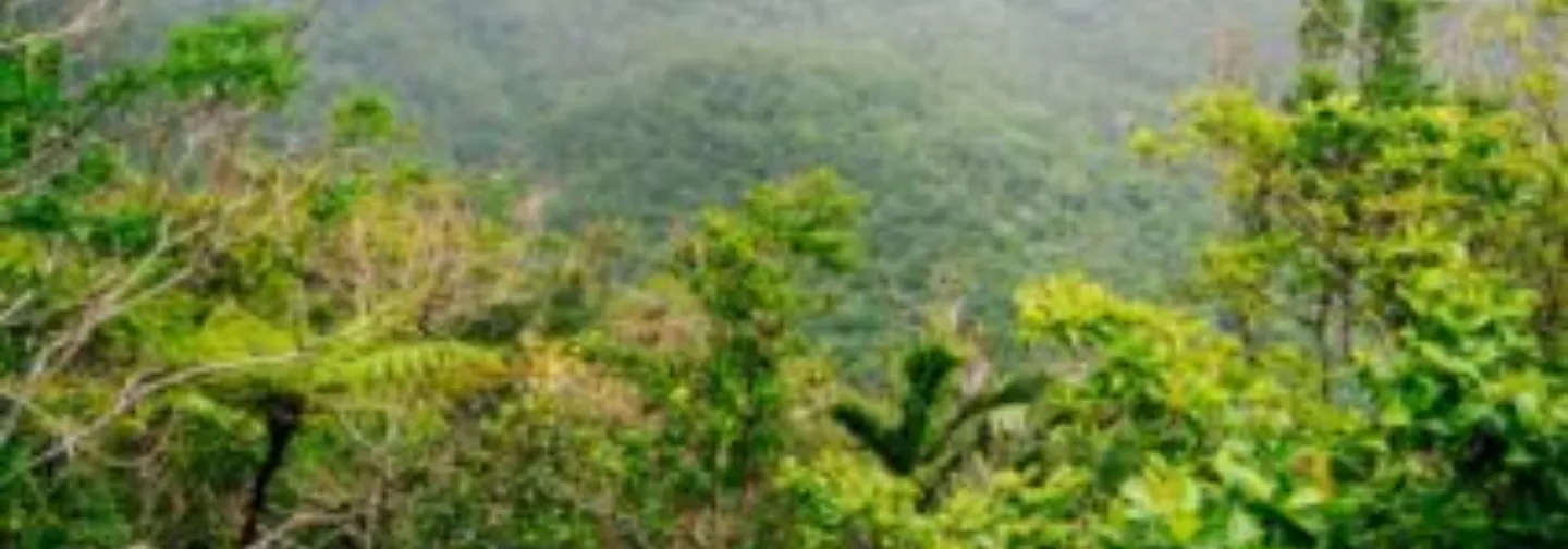
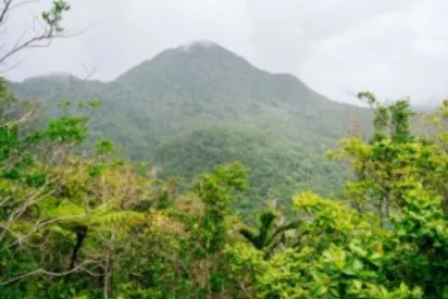
Basse-Terre:
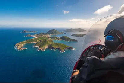
Dominated by the volcano, the Basse-Terre side, i.e. the left wing of what is called “Butterfly Island”, offers tropical forest landscapes and exceptional biodiversity. Between waterfalls, waterfalls and rivers, the National Park is full of hiking trails that can be crossed with or without a guide.
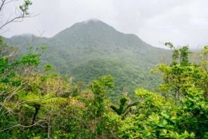
Photo: Adrien Ballanger
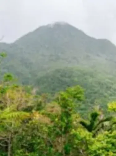
The volcano of La Soufrière:
Is there a better time for magic than when body and mind wander? And what a joy to reach this state after climbing kilometers to discover a breathtaking view! Indeed, at the end of a unique ascent, the summit of the Soufrière volcano, at an altitude of 1,467 meters, offers a 360 degree view of all the islands of Guadeloupe. By more or less confidential paths, the discovery of this panorama leaves you speechless, not to mention the astonishing spectacle of the craters and their sulfur vapors. To have the chance to access it, the weather plays a major role because the clouds often remain attached to its summit. Remember to check the conditions the same morning.
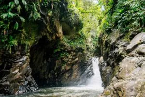
Photo: Adrien Ballanger
The Matouba Jump:
In another genre, more tropical forest, the conquest of the Matouba Water Jump is a surprising experience. Indeed, this short hike crosses a banana grove before descending a steep path to the Saint-Louis River. Here, the plant world deploys its strength and biodiversity is exceptional. Our guide explains to us that if the roots of trees are visible, it is because they cannot be planted in the rock. To survive, they balance each other and hold their own while intertwining: there is strength in numbers.
Ferns as far as the eye can see:
Further on, in this tropical forest, we discover tree ferns, a kind of umbrella that was already present at the time of the dinosaurs. More than 260 fern varieties have been recorded. We learn that begonia can be eaten raw and cooked and that resolute is a massive tree whose wood is used to make furniture, especially kitchen cupboards because it does not fear water. The flower with the little white tail can be eaten, it is called “rat tail” and has a peppery taste. We no longer stop our guide in his explanations. Then, once down, climbing up the river bed leads to a pool of water at the foot of a small waterfall. Extremely rigid volcanic rocks dominate, impressive! The rainfall and the morphology of the land are here to be controlled. A good way to check is to stack three small flat boulders on top of an emerged rock. If the water rises, they will no longer be visible. Also, be wary of soil that is too dry.
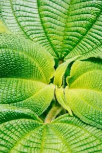
Photo: Adrien Ballanger
The Blue Basin:
For those who suffer from altitude differences, hiking to the Bassin Bleu is easy. Indeed, it starts on concrete ground, and the passage is then quite wide. On cloudless days, the Soufrière massif is visible. On the tree called white gum, there is a white paste that is used as a natural incense. On the way, we see equipment to supply the city of Gourbeyre with fresh water. Then, all the way, you can access by ropes to several pools in which it is possible to swim. Here you are: it's time to relax and learn to detect the song of the sugar bowl and the different families of birds that populate this paradisiacal place.
.png)
.png)
.png)
EXPLORE OUR ARTICLES
What to do in Guadeloupe in 7 days: complete itinerary from La Toubana Hotel & Spa
Between turquoise lagoons, tropical sweetness and the Creole way of life, Guadeloupe is a permanent invitation to relaxation and wonder.
Romantic getaway in Guadeloupe: ideas and tips for an unforgettable stay for two
If you are looking for a destination for a romantic getaway, choose Guadeloupe.
The 10 essential things to do in the Islands of Guadeloupe
If you are planning to visit the Islands of Guadeloupe on your next trip, you will love this piece of paradise! Paradisical beaches, breathtaking natural landscapes, waterfalls surrounded by lush forests and authentic villages, the Islands of Guadeloupe in the French Antilles is the ideal place for a dream stay. There are many activities and visits to plan. Here is for you, a small selection of the essentials to do in the Islands of Guadeloupe.
The island of Desirade, for lovers of tranquility and authenticity
La Désirade is one of the five islands that make up the Guadeloupe archipelago. It is located on the edge of Grande Terre (in front of the Pointe des Châteaux in Guadeloupe). The island is quiet and not urbanized. Its simplicity characterizes the island. If you want to discover the archipelago of Guadeloupe, far from the hustle and bustle of mass tourism, La Désirade has a crazy charm. An island with multiple assets that attract lovers of tranquility and authenticity.
The Saintes Archipelago: a paradise in the Caribbean
On the other side of the Atlantic, in the heart of the Caribbean, southwest of the Islands of Guadeloupe, is Les Saintes, a small archipelago of 13 km². Here, time has suspended its flight, giving way to relaxation, well-being and the sweetness of life. A paradisiacal setting that is sure to enchant you!
A day in Marie-Galante, the island of a hundred mills
Opposite La Toubana Hotel & Spa is Marie-Galante, the peaceful and authentic island in the whole of the Lesser Antilles arc.
There, the sugar cane fields stretch as far as the eye can see, paradisiacal beaches follow one another, the underwater fauna and flora surprise... Welcome to Île aux Cent Moulins, also known as Grande-Galette, which is worth a visit for a trip rich in discoveries.

Spa La Toubana, moments for yourself
To recharge your batteries and reconnect with your body, discover the La Toubana Spa, its wellness center, massages and signature treatments.
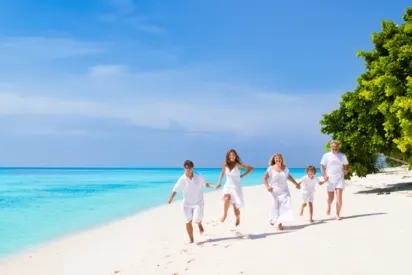
A multitude of activities to experience as a family
Between the Caribbean Sea and the tropical forest, Guadeloupe is the ideal destination for enjoying numerous leisure activities with the family.
Rainforest hikes
Dominated by the volcano, the Basse-Terre side, i.e. the left wing of what is called “Butterfly Island”, offers tropical forest landscapes and exceptional biodiversity. Between waterfalls, waterfalls and rivers, the National Park is full of hiking trails that can be crossed with or without a guide.